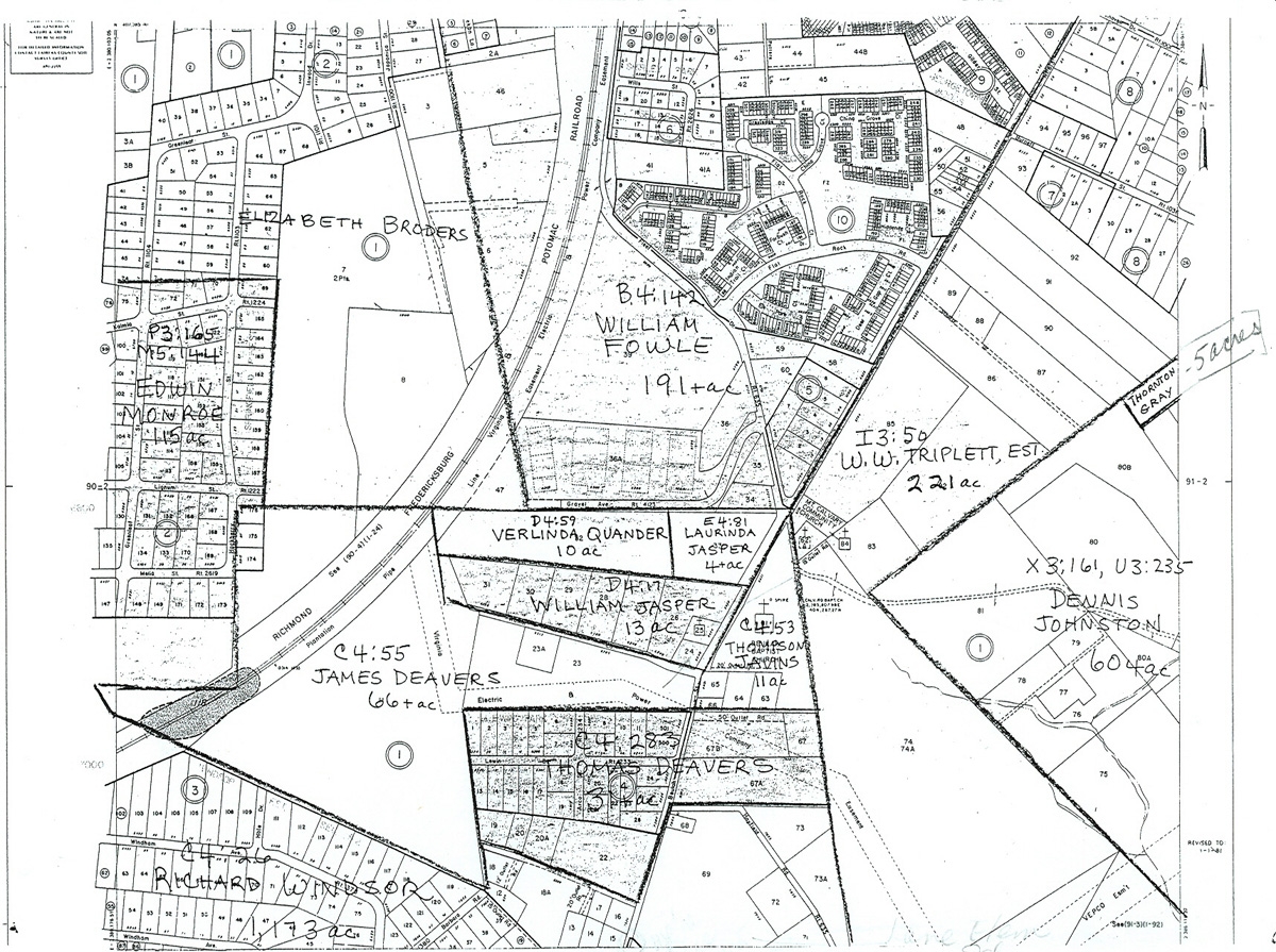
1860 Property Map superimposed on mid-twentieth century map
Title
1860 Property Map superimposed on mid-twentieth century map
Description
Useful to find the 13 acres of land that William Jasper bought in 1860. Also interesting to note that several of his neighbors were white landowners at this time.
Files
Citation
"1860 Property Map superimposed on mid-twentieth century map ," in Teaching with Laurel Grove School, Item #57, https://chnm.gmu.edu/laurelgrove/items/show/57 (accessed February 1, 2022).
